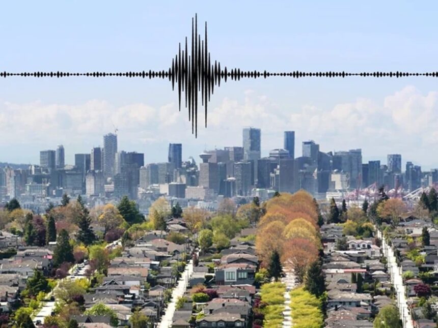
Vancouver, British Columbia, sits on the edge of one of the world’s most active earthquake fault lines, the Cascadia Subduction Zone. Seismologists agree this zone is overdue for a massive earthquake, often called “The Big One.” This fault stretches from northern California to Vancouver Island and could trigger a quake with a magnitude up to 9.0.
Experts don’t debate if a major quake will strike the region. They say it’s just a matter of time. Recent seismic studies show the risk is real and ongoing, with smaller quakes reminding everyone that the plates below are far from silent.
The city’s geology, especially in areas filled with soft soils, makes Vancouver more vulnerable to strong shaking and damage. Despite years of improvements in building codes and emergency plans, thousands of older structures remain at risk.
Today’s research leaves little doubt: Vancouver will face a massive earthquake sooner or later. Knowing what drives this threat—and what’s being done about it—can help people and communities prepare.
The Geological Threat Beneath Vancouver
Vancouver’s location above shifting tectonic plates means the city faces a looming threat that is both hidden and powerful. The forces at work deep below the surface are relentless, shaping the risk of a major earthquake. This section sheds light on the geological drivers behind Vancouver’s seismic hazard and why experts remain certain that another massive quake will happen.
Understanding the Cascadia Subduction Zone
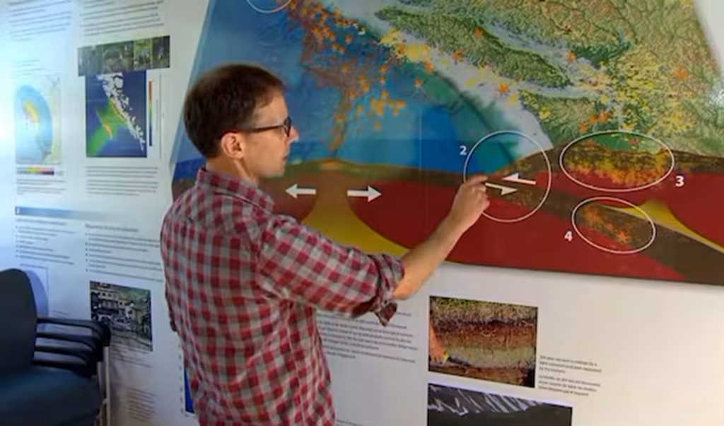
The Cascadia Subduction Zone sits a short distance off British Columbia’s coast. Here, the small Juan de Fuca Plate pushes under the much larger North American Plate. This action isn’t gentle—it’s a grinding, slow-motion collision that has built up intense pressure over centuries.
- The Cascadia Subduction Zone isn’t unique to Vancouver but stretches from northern California through Oregon and Washington, ending near Vancouver Island.
- When the locked plates finally slip, all that stored energy gets released in a single powerful quake.
- Experts say this type of fault has produced some of the largest earthquakes in North America’s history.
If you want a visual map or deep dive on the science, check out this overview from the Pacific Northwest Seismic Network about the Cascadia Subduction Zone.
Segmented Faults and Earthquake Magnitude Potential
The Cascadia zone isn’t just one continuous line—it’s made up of several segments. Each segment could rupture alone or in sequence, changing the size and impact of any quake. Scientists study these segments to predict different scenario outcomes for the region.
Key facts about the segments:
- Some segments are likely to produce earthquakes in the M8 to M9 range.
- The full rupture of the zone is capable of a rare but devastating “megathrust” event.
- Linked faults add complexity, making prediction harder.
- The specific geology beneath Vancouver, including underlying soft soils, could amplify shaking much more than rock.
Understanding this fractured structure is why experts warn that a major quake can be far more severe than the minor quakes Vancouver often experiences. For more details, explore how plate tectonics shapes British Columbia’s earthquake risk.
Historical Earthquakes and Recurrence Patterns
History is filled with clues about what Vancouver can expect. The most significant event tied to the Cascadia zone happened in 1700, when a huge quake—estimated between magnitude 8.7 and 9.2—rocked the coast and generated a tsunami that reached Japan. Geological studies have found evidence of similar quakes over the past several thousand years.
A few key takeaways:
- Major earthquakes have struck roughly every 300 to 600 years along this zone.
- The last “big one” was more than 320 years ago, putting the region within the expected window for another event.
- Local records, Indigenous oral histories, and sediment deposits all back up the scientific timelines.
For a fascinating recap of regional quakes and timelines, see History of Earthquakes in Cascadia and more details on the 1700 Cascadia earthquake.
Vancouver’s hazard isn’t just a future risk—it’s written into the landscape and memory of the region. Scientists use these stories and signals to urge better readiness for what past patterns say will come again.
Recent Seismic Activity and Cutting-Edge Research
Over the past few years, seismic activity in southwestern British Columbia has captured the attention of scientists, city officials, and residents alike. With tremors shaking parts of Vancouver and its surrounding communities, the reality of earthquake risk feels closer than ever. Advanced seismic research and detailed mapping now help experts better understand which parts of the city are most at risk, and why. Let’s break down the most recent findings.
Recent Earthquakes in Southwestern British Columbia
Southwestern BC has seen a string of noticeable earthquakes recently. In February 2025, a magnitude 4.7 quake rattled windows near Sechelt. Just weeks later, a 4.1-magnitude event struck east of Sidney. While these quakes didn’t cause major damage, their timing has many residents asking if they’re just the beginning.
Earthquake tracking websites provide up-to-the-minute insight into local activity, showing several small to moderate earthquakes each month. To see a real-time list and locations of the latest tremors, explore today’s earthquakes in British Columbia. Historical records and seismic sensors confirm that Metro Vancouver sits at the edge of a consistently active seismic region. Some scientists caution that while most events are minor, each tremor serves as a reminder of larger forces building up underground.
For a summary dedicated to the Vancouver area, check recent earthquakes in Vancouver, British Columbia, which catalogues even the smaller shakes many barely notice.
Advancements in Seismic Imaging and Hazard Mapping
Researchers in BC have rolled out new technology to map and monitor seismic hazards in unprecedented detail. Traditional maps gave a city-wide picture, but today’s seismic microzonation uses high-resolution imaging, ground sensors, and computer models to paint a much finer picture.
These advancements allow scientists to predict which neighbourhoods will shake the hardest when the next big quake hits. For example, engineers now use probabilistic seismic hazard mapping that also factors in local soils and sub-surface layers. This detail helps disaster planners focus resources, update building codes, and improve emergency response plans.
If you want to see how local researchers are applying these new techniques, review the Metro Vancouver Seismic Microzonation Mapping report. These efforts are already changing how the city prepares for earthquakes, guiding retrofits for older structures, schools, and bridges. The result? Vancouver is strengthening the weakest spots before disaster strikes.
Impacts of Local Geology on Earthquake Risk
Vancouver’s geology tells its own story when it comes to earthquake risk. Parts of the city are built on solid bedrock, but many neighbourhoods—especially in Richmond, Delta, and areas near False Creek—rest on soft, wet soils or artificial fill. These areas are at higher risk because soft ground amplifies shaking and is prone to a dangerous phenomenon called soil liquefaction.
When the ground shakes, soft or water-saturated soils can turn almost liquid, causing heavy structures to tilt, sink, or even collapse. This means that older buildings in low-lying or riverside neighborhoods face greater threats—not just from shaking, but from shifting ground beneath their foundations.
Detailed seismic hazard maps now highlight these risky zones, helping city officials and engineers target upgrades. To dig deeper into how mapping and research guide land use and emergency plans, the Earthquake Hazard Mapping for Land Use and Emergency outlines British Columbia’s long-running mapping program.
In summary:
- Older neighbourhoods with soft ground are at the highest risk.
- Modern mapping shows where local geology could turn small earthquakes into major disasters.
- The best protection comes from a combination of new research, strong building standards, and ongoing upgrades.
Staying informed with research, new maps, and science-backed planning is key to staying a step ahead of Vancouver’s next major quake.
The Human Cost: Vancouver’s Vulnerabilities
When scientists warn that a major earthquake is “just a matter of time” for Vancouver, they’re not just thinking about buildings and bridges. A disaster of this size would hit where people live, work, and connect, putting thousands at high risk and testing the city’s ability to bounce back. Let’s look at the cracks in our armour—from shaky infrastructure and dense neighbourhoods to the threat of tsunamis and the social challenges of preparedness.
Infrastructure and Urban Resilience Challenges
Vancouver’s skyline is known for its glass towers and heritage neighbourhoods, yet these symbols of city life also paint a picture of risk. Many older buildings went up before modern seismic rules took hold. Reports suggest that over 6,100 structures face severe damage risks, with some neighbourhoods standing out for their vulnerability. Kitsilano, Mount Pleasant, and the Downtown Eastside, all rich in history, are filled with brick, wood, and older high-rises that may not withstand a big quake.
Some of the city’s key bridges—like Cambie, Granville, and Burrard—could suffer major damage, cutting off road access for days or weeks. Experts are concerned especially about tall concrete buildings, as new research suggests Vancouver’s building codes have historically underestimated their risk in a strong seismic event. When power lines snap and water mains break, utilities will go down, and fires could follow.
Economic losses are hard to picture but impossible to ignore. Estimates put the potential bill around $17 billion—a number that doesn’t reflect lost jobs, families displaced, or years of rebuilding. To see the full scope of what’s at stake, the UBC Civil Insights on Vancouver Seismic Risk Report offers sobering numbers and scenarios.
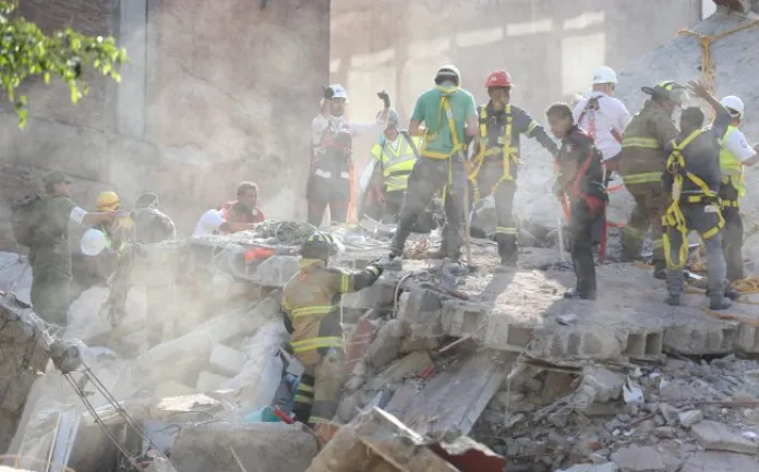
Still, it’s not just concrete and glass that will suffer. The dense population in vulnerable neighbourhoods means more people are at risk for injury, loss, and hardship. In the wake of a mega-quake, hospitals could be overwhelmed, and emergency responders stretched thin. Neighbourhoods least able to bounce back today could face the slowest, hardest road to recovery.
Potential for Tsunamis and Secondary Hazards
The direct shaking from a major quake is only the start. Vancouver’s location near the coast brings added threats, with tsunamis high on the list. While the city’s geography tends to shield it from the full force of an ocean-born wave, certain scenarios could still put coastal areas at risk. Recent studies show that while an extraordinary tsunami is rare for Vancouver’s core, even smaller waves can cause trouble for low-lying areas and waterfront facilities. Issues like damaged wharves, ferries, and sea bus terminals could strand or endanger commuters. The Province of British Columbia’s tsunami safety resource covers evacuation zones and what residents can do now.
But there’s more. The soils beneath parts of Richmond, Delta, and even some Vancouver neighbourhoods are soft and waterlogged. During strong shaking, these can behave like quicksand in a process called soil liquefaction. Buildings may tilt, sink, or fall. Landslides on unstable slopes, ruptured gas mains, and even fires triggered by broken infrastructure can quickly multiply the dangers and make rescue work even harder.
How Prepared Are Local Communities?
Big preparedness efforts are underway in Vancouver, with both government and community groups stepping up. But the truth is that readiness remains uneven—especially among those who live in older or more affordable buildings. City agencies run regular education sessions and even host events like Earthquake Day to help residents face the risks and take practical steps.
Many people have started basic emergency plans, like keeping an emergency kit and securing furniture. Yet for renters and people in older apartments, there’s often less control over building upgrades and safety improvements. Language barriers, cost, and just the busyness of daily life leave some parts of the population less prepared to handle disasters.
Practical tips—like having a grab-and-go bag, signing up for alerts, and knowing local evacuation routes—can make a big difference when seconds count. The City of Vancouver’s emergency preparedness page offers guides, training, and support to help everyone get started, step by step.
Community resilience doesn’t just mean waiting for help. It begins with conversations at home, in schools, and workplaces about earthquake risk. Action can be as simple as checking on neighbours, joining disaster response teams, or attending city-led training sessions. The more people know and prepare, the safer Vancouver will be when the ground finally gives way.
Preparing for the Big One: Response Strategies and Public Readiness
Experts say Vancouver faces a major earthquake in the future, but how ready is the city to handle it? Preparation is about more than storing water and batteries—it’s about having coordinated response strategies, up-to-date technology, and a community that knows what to do when disaster strikes. This section details how Vancouver is stepping up emergency plans, upgrading technology, and getting everyone involved, from government leaders to everyday residents.
Vancouver’s Emergency Preparedness Framework
Vancouver has worked for decades to carve out a solid emergency plan. The city reviews seismic risk, updates strategies, and prioritises programs that keep people safe and city services running after a disaster. The core idea is simple: planning saves lives and shortens recovery time.
The framework includes:
- Detailed response and recovery plans. Vancouver created a set of guiding actions, outlining how to restore services, protect the most vulnerable, and communicate after a quake.
- Improved building codes. Both public and private buildings must meet seismic standards. While new rules help, many older buildings—especially in historic neighbourhoods—pose a challenge. The Office of Housing and Construction Standards details the seismic updates that guide today’s construction.
- Disaster support hubs. The city has set up 25 disaster support hubs across Vancouver. After a major quake, these locations provide vital information and resources, helping people to connect, get first aid, or find shelter.
- Routine plan reviews and public outreach. Officials perform drills and update emergency policies to keep up with scientific findings and urban growth. They also invite residents to attend workshops, making sure everyone knows about risks and solutions.
Curious about how all these pieces work together? The city’s official emergency preparedness guide is packed with actionable steps and templates.
Early Warning Systems and Emerging Technology
Seismic science isn’t just about record-keeping. It has led to new technology that helps save lives. Vancouver’s partnership with researchers at UBC and the Earthquake Engineering Research Facility means the city now benefits from an advanced earthquake early warning system.
Some highlights:
- Earthquake early warning (EEW) systems use networks of land and undersea sensors to detect the first seismic waves. They provide up to tens of seconds of notice before stronger shaking arrives. This short warning allows schools, hospitals, and transit to take action—closing valves, pausing trains, and moving people to safer areas. Learn more about Canada’s growing earthquake early warning network.
- Public alerts are sent out through phones, radio, and websites. In a matter of seconds, people can be told to take protective actions—like “Drop, Cover, and Hold On”—before the quake is fully felt.
- Investments in sensors and monitoring continue, with new upgrades going in across the province. Programs described by BC’s Earthquake Early Warning Sensors stress that even a few seconds can mean the difference between minor injuries and major casualties.
- Emerging technology also includes interactive risk maps and online dashboards, so every resident can pinpoint their risk level and understand evacuation routes.
For those curious about the science behind it, Ocean Networks Canada’s early warning initiative gives a behind-the-scenes look at how land and sea sensors work in unison.
Public Education, Drills, and Community Engagement
Getting ready is a community effort. It doesn’t happen with top-down planning alone. City leaders, researchers, and local organizations constantly work to keep earthquake preparedness at the top of mind for everyone in Vancouver.
Here’s how public education and involvement are making a difference:
- Workshops and training sessions. Vancouver hosts free classes where people learn practical skills, like assembling emergency kits, securing furniture, and planning safe exits. Find a list of options and sign up for regular emergency planning workshops.
- Drills and city-wide events. Regular practice, like the annual ShakeOut BC drill, teaches people how to react quickly. Local schools, offices, and families rehearse what to do during shaking, helping turn knowledge into muscle memory.
- Accessible resources. The city keeps up-to-date videos, step-by-step checklists, and quick-start guides on its emergency preparedness page.
- Community programs. Disaster support hubs and neighbourhood leaders are trained to help spread the word and coordinate actions after a quake.
- Building a culture of safety. Simple actions, like talking about your emergency plan or practising with neighbours, start conversations and build trust that lasts beyond a single drill.
Staying safe isn’t about one big action. It’s what happens day to day—learning, teaching, connecting, and building confidence to act when moments count. The more people practice and share, the fewer surprises there are when the ground starts to shake.
Conclusion
Scientists have made it clear that a major earthquake will hit Vancouver at some point—it’s only a matter of when. Years of research, the city’s history, and the region’s geology all point to a real and growing risk.
Vancouver has made big strides in emergency planning, early warning systems, and public education. Stronger building codes and better community programs help, but staying prepared is a job that never ends.
Everyone in the region plays a part in building safety and awareness—checking in with neighbours, staying informed, and keeping emergency plans up to date. Progress has been made, but the need for constant readiness and community connection remains. Thanks for reading and sharing your voice as Vancouver keeps working together for a safer future.


